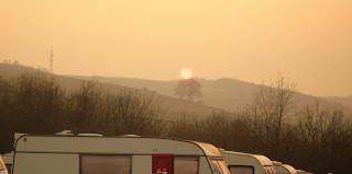
2nd April 2011, A wet start until the sun came out at lunchtime.
Start: Crag Inn lay-by, OS map 24, Grid ref: SJ98270
Distance: Approx 10 miles circular walk.
Time: 4 - 4.5 hrs.
 |
| Just map checking |
We parked in the lay-by 50 yards east of The Crag Inn which is where we started the walk. Going through the small gate at the bottom of the drive we followed the path up the hill across several fields through the gates in the walls. Crossing a small brook before continuing uphill again to follow the footpath sign to Oakenclough. Crossing a stone stile on the R onto a tarmac path to the L.

At the bottom of the tarmac road we turned right and made our way to Greenway bridge and over the stile on the R. We walked up the hill with the stream on our L, crossing a small wooden bridge (a nice spot for a picnic).
And as we went through the valley we past an old ruin of a stone shelter that Jasper found particularly interesting.
Going through the freestanding gate posts it is easy to lose your direction, but if you keep to the right and cross the stile you will reach a pond. We then headed left up a few steps and through another gate up a steep hill which leads onto Oakenclough and the rough, sometimes boggy moorland. Looking back we got a good view of Shutlingsloe.
 |
| Looking back towards Shutlingsloe |
Carrying on across Oakenclough we were rewarded by a stunning view of Cheshire and Joddrell Bank in the distance. Following the path to the R over a stile and descending the steep path between two fields.  |
| Path to the Hanging Gate pub |
At the bottom we were greeted by the Hanging Gate pub and a wonderful welcome. Roaring fire, despite the fact it was 16 degrees outside and friendly faces behind the bar. A well deserved pint of shandy and we were ready for the next part of our walk.
Out of the pub we followed the road down to a sharp bend in the road where we headed R up Quiet Lane. This took us to Macclesfield forest where we followed the road down to Trentabank reservoir and the visitor centre. If you want you can detour onto the path through the forest. Once at the carpark we stopped for a cup of tea and a chat with John Sellors who runs the Nice Nosh snack van there. We had a cracking cup of tea but declined the offer of a piece of Parkin or any of the other delicious looking home cooked treats.
John was a wealth of knowledge about the area, having lived there for many years. He suggested we take a walk off the beaten path and follow the blue route (it looks black on the posts) up to the Standing Stone car park. He told us that the forest had been created to stop soil run off into the newly built reservoir in the 1940's. The trees are now fully matured so they are in the process of felling some and re-planting.
We followed the blue route on the marker posts which took us through the woods and across a small stream. Jasper was very excited about having a paddle and even found a frog to sniff at.
 |
| What's that? |
After crossing the road at this point, we carried on up the path towards Standing Stone.
R at the top towards Shutlingsloe we could now see evidence of the re-planting.
A little further along the path we veered off to the left to climb up Buxtor for what John had told us would be a wonderful view at the top. He wasn't wrong. It was well worth the detour for the view of Cheshire and Trentabank reservoir, and to avoid the crowds.
Crossing a crumbling wall at the top, we walked along the sometimes boggy path, through the indistinguishable path in the heather towards our goal of Shutlingsloe which we could now clearly see in the distance.
Following the well defined path up Shutlingsloe was easy, just like walking up a steep stone staircase really. The views at the top were truly amazing and you can see why this outcrop of hard millstone grit gets its name as the Cheshire Matterhorn. The shape is very distinctive. It may not be on a parr height wise, standing at just 506m but well worth the climb to see Macclesfield forest laid out below to the North, Wildboarclough to the South East, the Cat and Fiddle over to the East. Even the Welsh mountains can be seen in the distance on a clear day.
 |
| Shutlingsloe |
 |
| King of the Matterhorn! |
 |
| Waiting for me to catch up! |
 |
| How did I get down that? |
The descent towards Wildboarclough is a very steep one on an uneven path. This can play havoc on the knees so it is best to take your time and use walking poles. A chat with fellow walkers on their way up gives you time to catch your breath. Then follow the road to the right and at the bottom you will find yourself back at the lay-by. A short stroll back to the Crag Inn will reward all your efforts. We may not have seen any Wild Boar, but sausage 'n' mash for tea certainly made up for it.


